- Printed Journal
- Indexed Journal
- Refereed Journal
- Peer Reviewed Journal
P-ISSN: 2349-6800, E-ISSN: 2320-7078


Journal of Entomology and Zoology Studies
2019, Vol. 7, Issue 6
Spatial: Temporal distribution of cephalopods off veraval coast, Gujarat
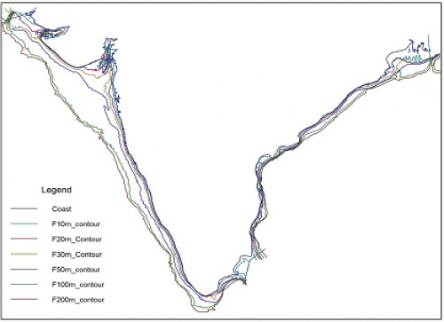
Fig. 1: Map of coastline and bathymetric contour used as shape file
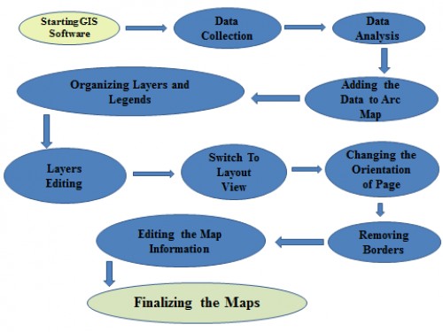
Fig. 2: Flowchart or procedure for making GIS Maps
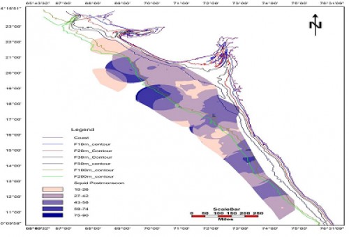
Fig. 3: Spatio-Temporal Fishing Grounds for Cephalopods during Post Monsoon Season
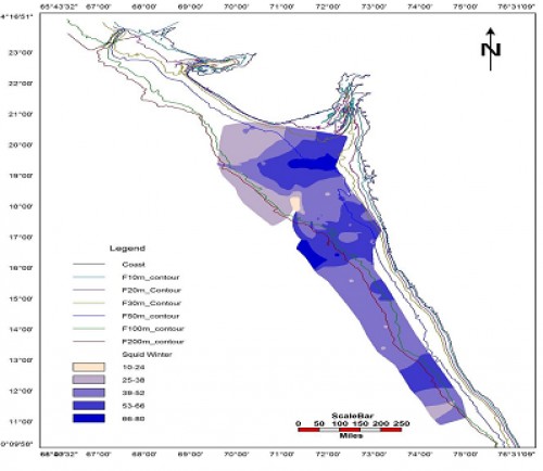
Fig. 4: Spatio – Temporal Fishing Grounds for Cephalopods during Winter Season
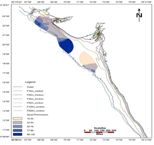
Fig. 5: Spatio - Temporal Fishing Grounds for Cephalopods during Pre Monsoon Season
Indexed In

Hard Copy Subscription
Click Here for more InformationOur Other Journal

Important Topics
Related Links
Related Journal Subscription
Important Publications Links
Important Links

Journal of Entomology and Zoology Studies

- Home
- Editorial Board
- Archives
- Instructions
- Membership
- Publication Ethics
- Publish Book (ISBN)
- Make Payment
- Contact Us
- Helpline No.: +91-9711224068
- Fast Publication: +91-7048922346
- Toll Free: 1800-1234070